Alcohol consumption
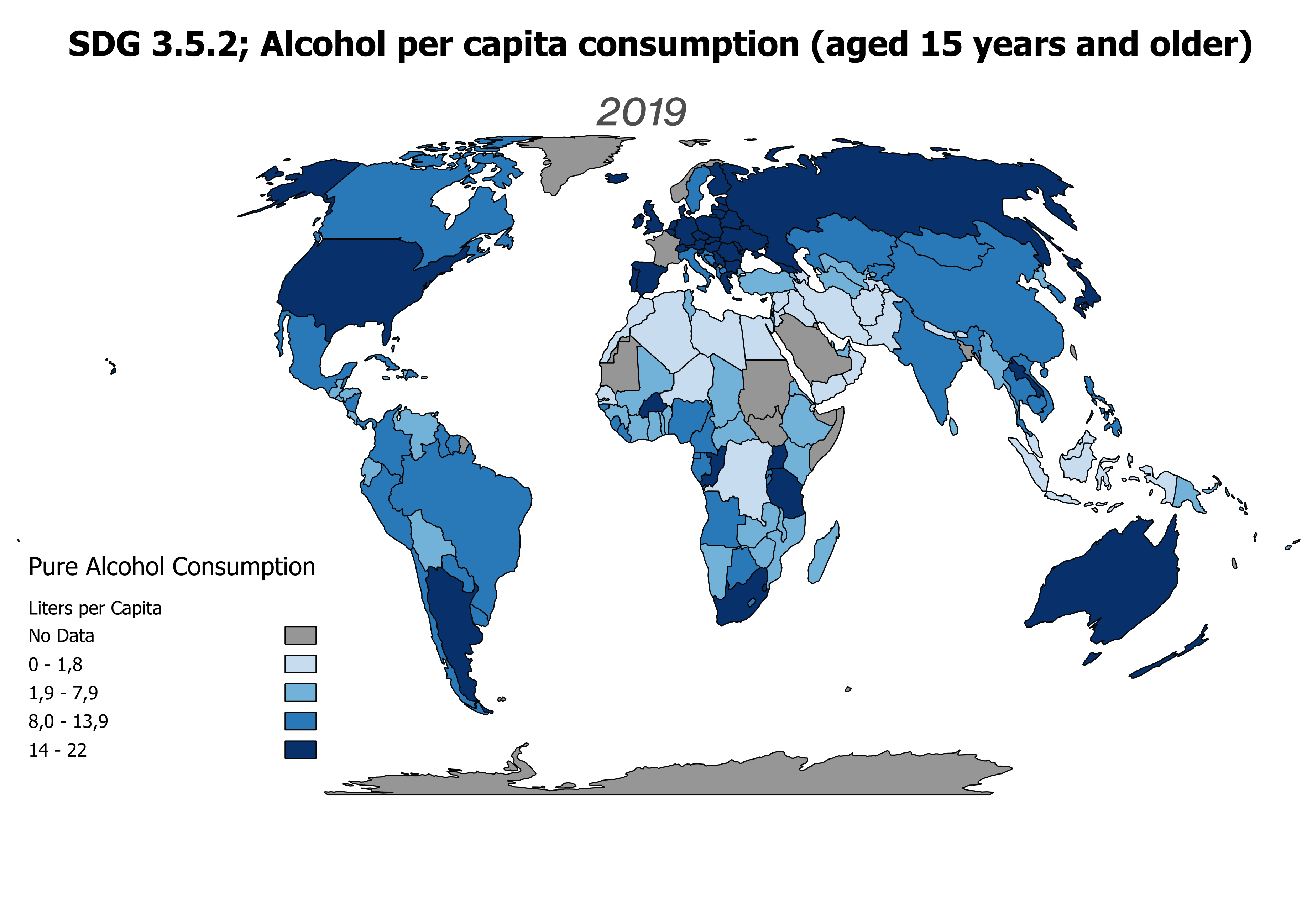
Choropleth map showing SDG indicator 3.5.2: alcohol consumption.
As a bachelor student at University College Utrecht, my studies allow me to explore a wide range of subject areas, in my case centred around physics and marine sciences. My interest for environmental sciences has now led me to exploring the science and art of map making with Geographical Information Systems (GIS). This website shows you my portfolio giving an overview of my acquired GIS knowledge and skills. Please browse through my website to find interactive and carefully stylized maps, broadcasting the range of GIS techniques that I have learned in ArcGIS Pro, QGIS, and Google Earth Engine.
Choropleth map showing SDG indicator 3.5.2: alcohol consumption.
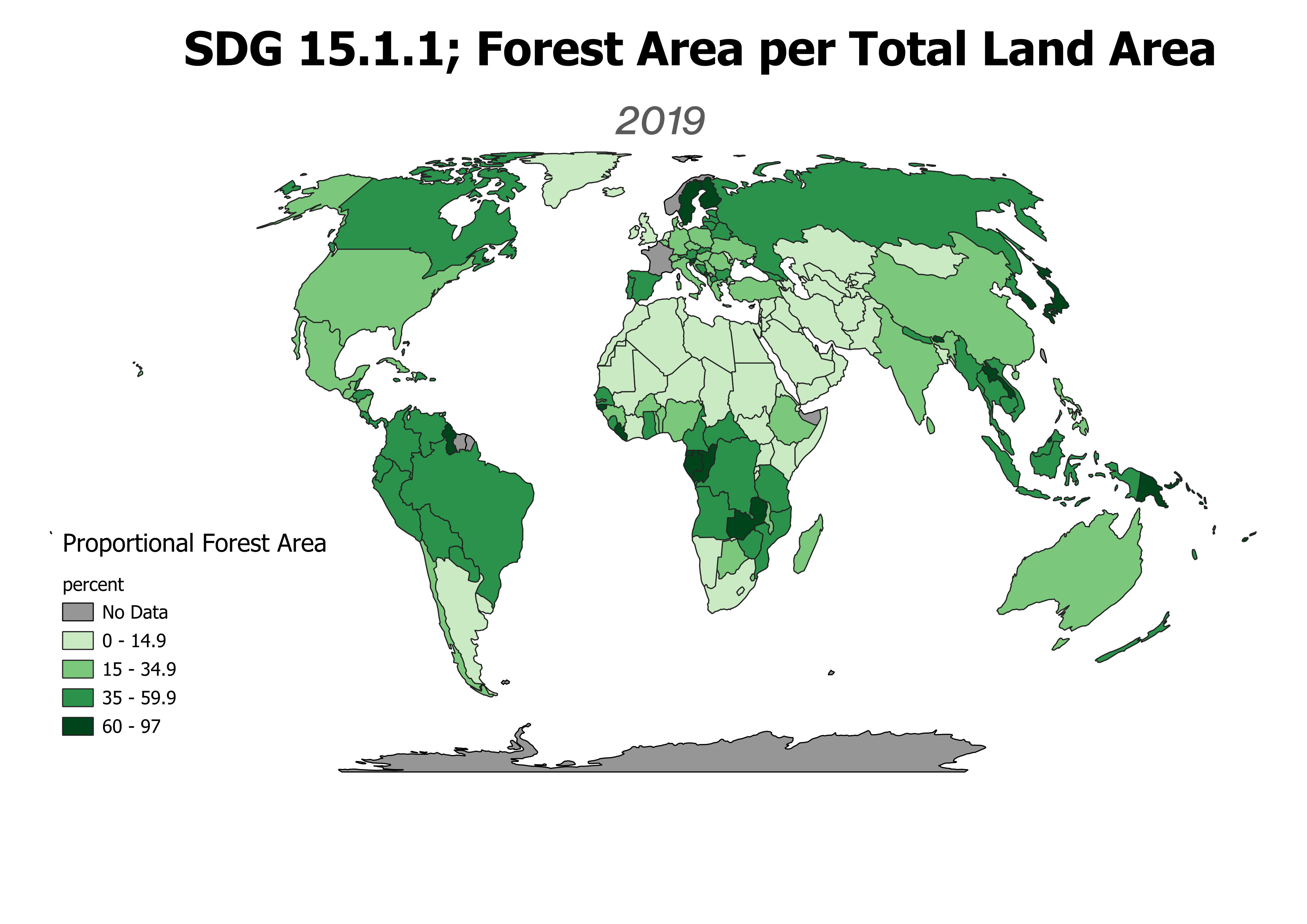
Choropleth map showing SDG indicator 15.1.1: forest coverage
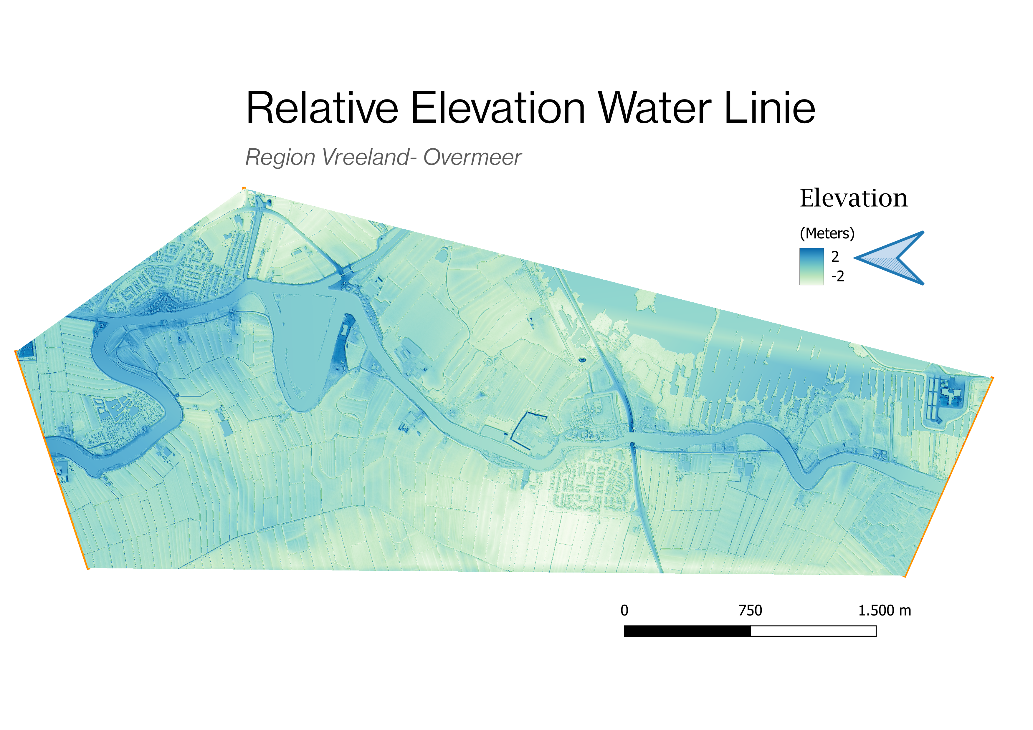
A Relative Elevation Model (REM) with respect to the elevation of the river the Vecht.
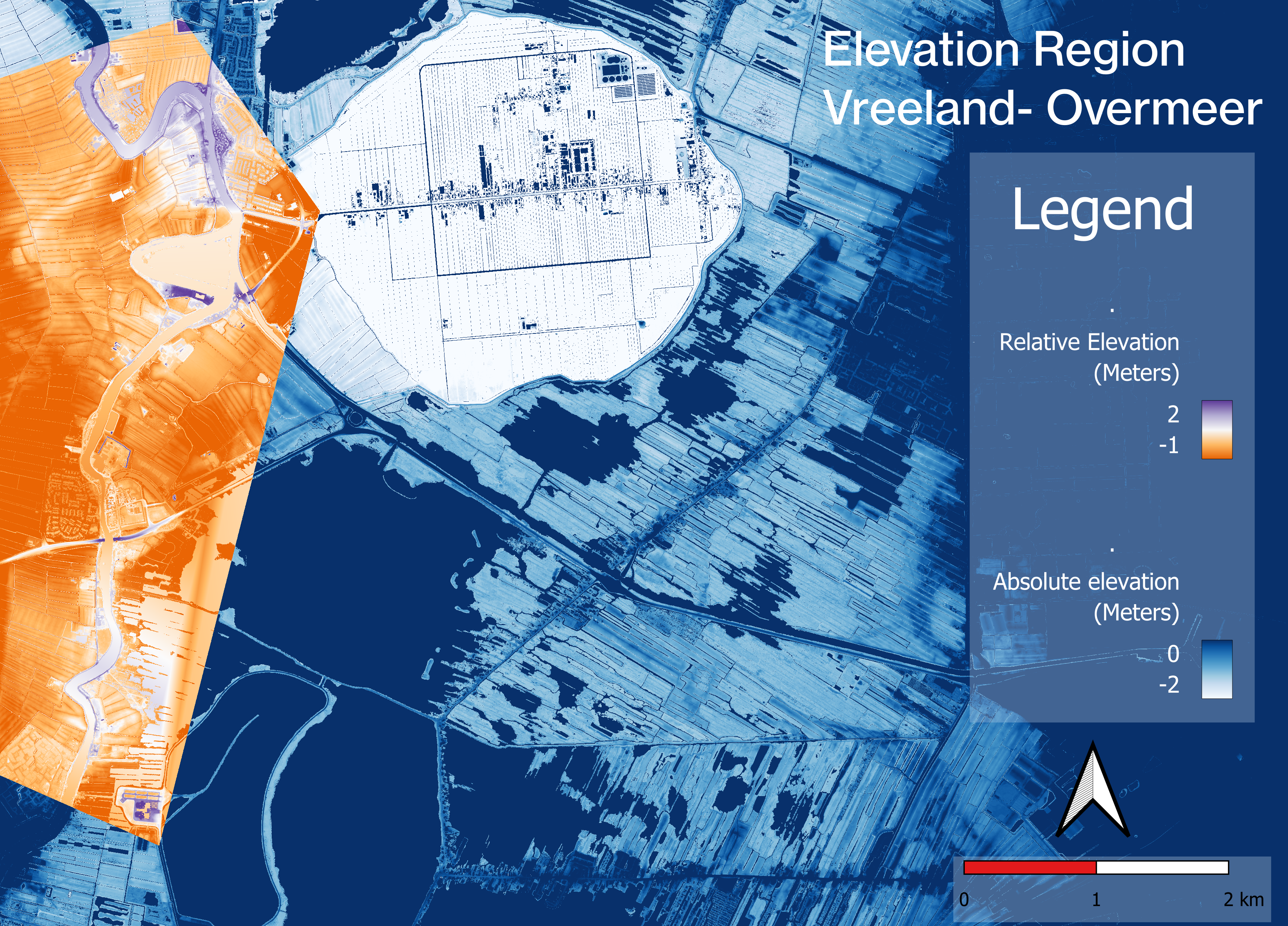
A REM (orange) embedded in a Digital Elevation Model (DEM).
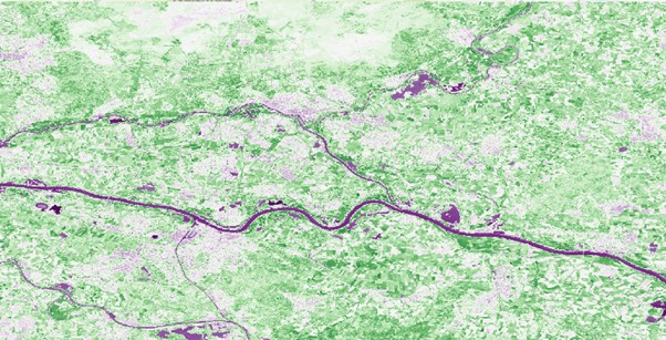
A supervised pixel-based land cover classification.
Normalized Difference Vegetation Index (NDVI) map.