Elevation Map
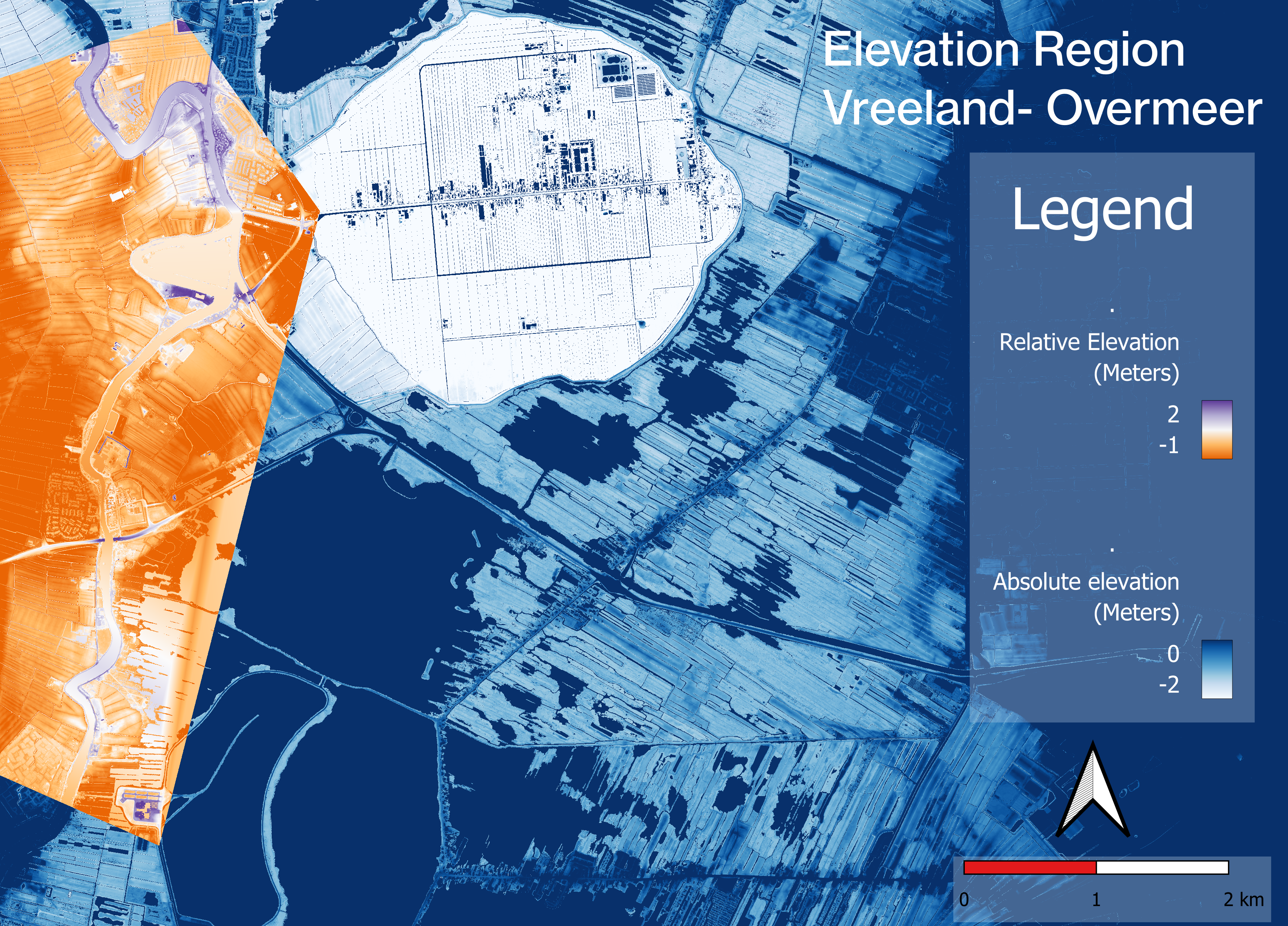
A Relative Elevation Map (REM) can be used to show landscape elevation relative to some entitity in the landscape, in this case the river the Vecht. A REM allows for the detailed analysis of landscape features that would otherwise not be prominent in an absolute elevation map.
This map shows the relative and absolute elevations in the region of Vreeland-Overmeer (between Utrecht and Muiden). The orange part of the map shows elevation relative to the river the Vecht. The background in dark blue shows absolute elevation levels.

Production of the map
This map has been produced in QGIS, using the Digital Terrain Model (DTM) from an open data source. To make a Digital Elevation Model (DEM) I merged the downloaded data and added contrast to it. The DEM is depicted in dark blue in the figure above.
I then detrended the baseline elevation to create a map relative to river height, using the cross section method. This method uses an interpolation of separately measured elevation points in the river. The interpolated elevations are then substracted from the DEM to create a detrended DEM, or REM.